Exploring the Baviaanskloof World Heritage Site
As part of Tourism month activities we were invited by the Eastern Cape Parks & Tourism Agency to join them, some of the surrounding areas tourism products and some geocachers from Port Elizabeth on an educational trip to the Baviaanskloof World Heritage Site. The trip had two purposes, the first to introduce tourism products to the Baviaanskloof and the second to also familiarize them with the world wide treasure hunt called geocaching.
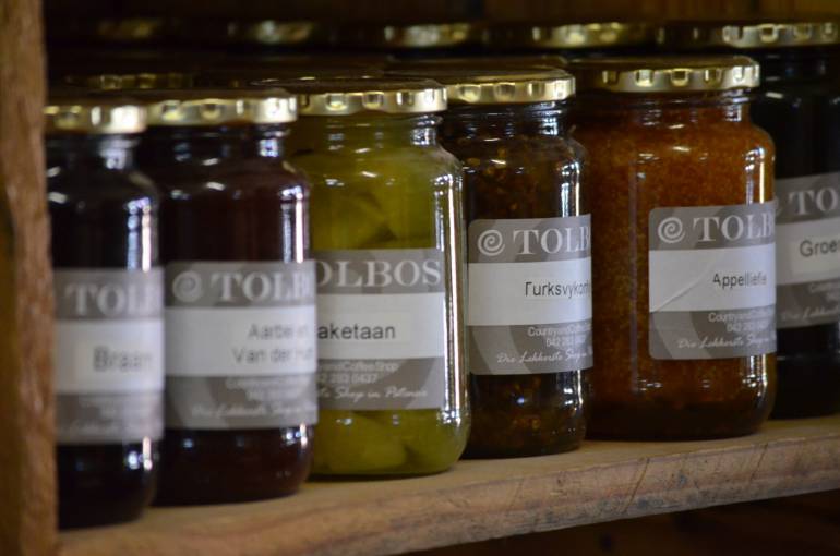
Tolbos restaurant and farmstall in Patensie is another little treasure in the area and was the start of our trip into the Baviaanskloof.
The Baviaanskloof is a renowned heritage site and is home to an abundance of animal and plant life, and is flanked by two mountain ranges and spans a distance of 200km. The Baviaanskloof forms part of the Cape Floristic Region and was listed as a World Heritage Site because of two reasons. Firstly because of the unique ecological processes of the site which includes the interesting patterns of endemism and adaptive radiation that are found in the flora as well as their reproductive strategies, pollination biology and nutrient cycling as well as other distinctive ecological processes found at the site.
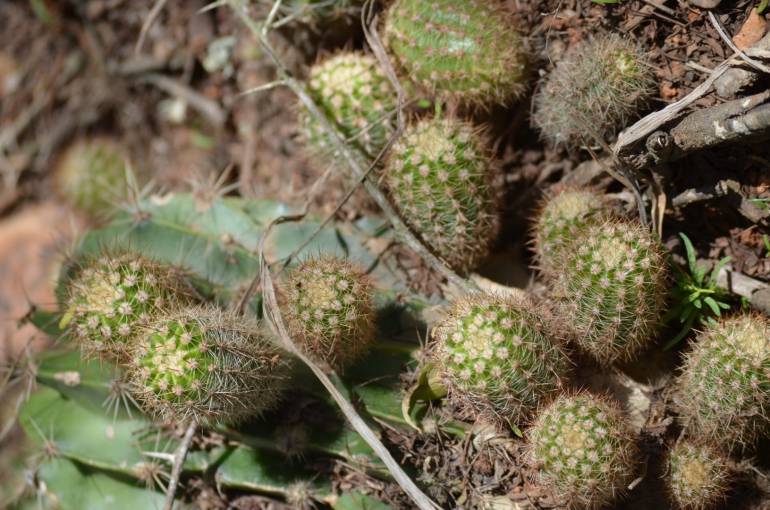
Some of the wide variety of plants of the Cape Floristic Region
Secondly because of its Biodiversity and threatened species. The Cape Floristic Region has a more diverse plant array than any other similar sized areas in the world. The number of species per genus and family are the highest given for various species-rich regions in the world and the density of species is also among the highest. The region also displays the highest levels of endemism (species that occur nowhere else in the world) at 31.9%.
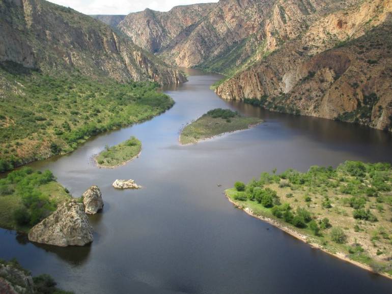
Photo of the Kouga Dam close to the Doodsklip campsite in the Baviaanskloof by Mark Maritz
The kloof is also home to various animal species such as Buffalo, Eland, Red Hartebeest, Cape Mountain Zebra, Kudu and the two main predators, Caracal and Leopard, amongst others. Baviaanskloof owes its name to the Baboon who can be found here in multitude.
There are various accommodation options available in and around the kloof. It is important to know that some parts of the Baviaans are only accessible by high clearance or 4X4 vehicles. One can call 042 283 0630 to check the status of the roads prior to departure. Entrance to the park requires a permit obtainable from the Eastern Cape Parks & Tourism Agency at 043 701 9600.
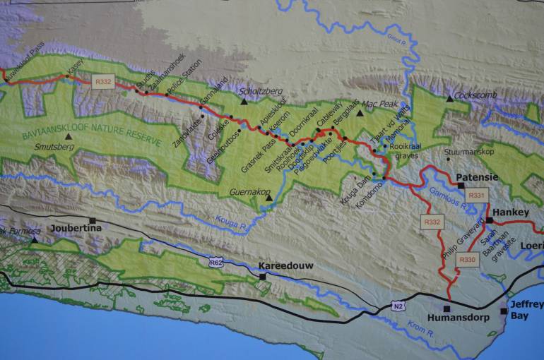
Map of the Baviaanskloof at the Baviaanskloof World Heritage Centre
Geocaching is a real-world, outdoor treasure hunting game using GPS-enabled devices. Participants navigate to a specific set of GPS coordinates and then attempt to find the geocache (container) hidden at that location. There is a number of geocaches placed in the Baviaanskloof/Patensie area and thus adds another dimension on exploring the area. Geocaches are normally placed at sites that have some sort of point of interest such as the first one done on the trip at the Sarah Baartman grave. Other interesting caches include one close to the World Heritage Site Center, Grootrivier Poort which is at a cave which has one resident bat and an Earth Cache about a geological rock formation that is in the shape of Queen Victoria's Bust.
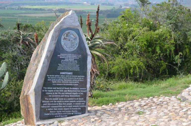
One of the geocaches are hidden close to the Sarah Baartman grave in Hankey.
There are over 6 million geocachers worldwide at present and they will travel long distances to go and find some of these caches. Thus by placing caches at interesting points it will create more interest in your area and bring additional visitors there that might not have known about it. You can learn more about geocaching by taking up the hobby at www.geocaching.com.
You can see the Nelson Mandela Bay and surrounding area's geocaches here: https://www.geocaching.com/map/default.aspx#?ll=-33.885406,25.388565&z=10.
Categories
Featured Posts
-
Unleash the Summer: Essential Travel Hacks for Saving, Safety and Smart Packing
As the temperature rises and the days grow longer, the allure of summer travel becomes…
-
Gqeberha: Tales of Adventure and Exploration
Although this adventure quote might sound cliche and a bit overused, it’s one thing that…
-
101 Things to do in and around Nelson Mandela Bay (Port Elizabeth/Gqeberha)
With an abundance of things to see and do in and around Gqeberha (Port Elizabeth), it is…